LocaleScan: Empowering Real Estate Decisions
LocaleScan is an innovative platform that is transforming the way people make real estate decisions. It provides users with a detailed and comprehensive overview of the area surrounding a real estate property, using cutting-edge tools and AI.
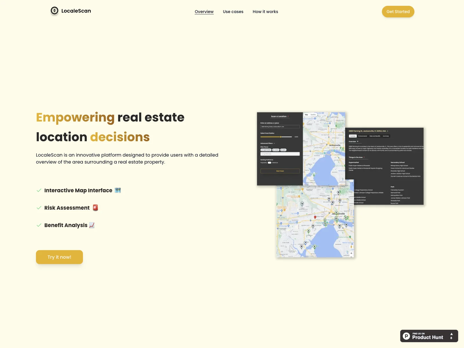
Overview
LocaleScan offers a wealth of information to assist users in their real estate endeavors. Its interactive map interface is a standout feature, allowing users to zoom in and out and explore multiple layers of information about the property's vicinity. Customizable markers make it easy to identify different types of places, such as schools and medical facilities.
Core Features
The risk assessment component of LocaleScan is crucial. It provides up-to-date statistics on crime rates, environmental hazards, and the economic stability of the area. This helps users make informed decisions about the potential risks and benefits of a particular location.
Another significant feature is the benefit analysis. It showcases local amenities like restaurants, cafes, and shopping centers, as well as educational and childcare facilities. This gives users a clear understanding of the convenience and lifestyle options available in the area.
Basic Usage
Using LocaleScan is straightforward. Users simply need to specify a location to analyze, define a scan radius, and then enjoy the detailed results. This makes it easy for home buyers, renters, real estate investors, agents, urban planners, and developers to make more informed decisions.
In conclusion, LocaleScan is a powerful tool that empowers users to make smarter real estate decisions by providing them with in-depth and accurate information about the locations they are interested in.